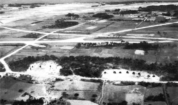
Aerial Pictures of Ie Shima, Iejima, Exhibit.Click Here are some great Aerial Pictures of the island of Ie Shima in the 40's compared to Ie Shima now. |
|
| WW1 Aircraft | WW2 Fighters | Jet Fighters | Ships | Tanks | Guitars |
|
|
|
|
Photos of Ie Shima. |
Click Arrow to Start Exhibit Tour |
|
|
|
|
|
|
| A
from 1st LT Andrew J. Lockett
I am a Marine stationed on Ie Shima. There is a training range on the north-west corner of the island that contains a 5000' coral runway, a simulated LHA deck, and a drop zone for parachute training. Units from all four armed services in the Okinawa area conduct training on the island, but the Marine Corps runs it. The three runways that were in use when World War 2 ended are still here, however, the eastern one is now abandoned and is used as a thoroughfare for the locals to get from the north to the south side of the island, the middle one is now used by a small civilian air carrier, and the western one is still unimproved and is part of our training range. The 12 Marines and one Sailor who run the range all live in a compound located about one mile north west from Gusuku Yama, which we run to the top of on Mondays for PT. I can't say enough good things about my tour here and am very interested in the history of the island. If anyone would like to share their accounts of their time on Ie Shima, please feel free to contact me. Operations Support Detachment, Ie Shima DSN 622-7333/7380, Fax 622-7380 lockettaj@mcbbutler.usmc.mil |
|
5-22-2010 Jeff, Not sure if you're using Google Earth or not but this is a place mark for my latest expedition. I found an excellent website regarding the Battle of Ie Shima http://www.history.army.mil/books/wwii/okinawa/chapter7.htm  I'm got a Garmin Edge 705 Handheld GPS and I'm kinda able to use old maps on the internet to semi-pinpoint where I think some objects are. My goal is to photograph the general area. As the article reads the heaviest fighting here was on the assault on Mount Gusuku (the name today) and the worst fighting occurred near Government House Hill and the area just below called Bloody Ridge. My point I have marked is not exact but real close. I'm amazed that many of the roads from the 1945 maps are the same as what exist today, only now paved. I suspect our presence here wasn't long enough to make a big difference in landowners and such. My main goal is to take some photos and draw the "What a difference 65 years makes" conclusion. Also below all this to the South are the landing beaches designated Red 3 and Red 4. Just up the beach from them I saw a photo that showed the cave defenses. I should be able to find roughly where these caves were and see if I can find any remnants of them. Most of this is residential now so it might be tough to find the caves. I'll be doing this search via bicycle so that gives me a little more freedom to move around and more time to look and photograph. While on the other side of the island on the USMC range I noted the tide was very low the other day. About a 10 minute walk from our simulated LHD ship is a beach and I've always wanted to walk further down the beach but the tide always prevented getting around some corners. I was able to walk that beach for several hundred yards for the first time ever and found lots of evidence of man made "caves" most of them just holes in the rock faces. Some appeared natural but it was clear some were shaped by man as defensive positions. I've got some photos but haven't yet dumped them from the computer. Not really seeking out any mysteries today but just trying to imagine how it was 65 years ago our guys. If I turn up anything interesting I'll be sure to share with you. John Hagensieker Click Here is John's webpage Some great pictures, "Ghost of Ie Shima" by John E. Hagensieker |
 Might
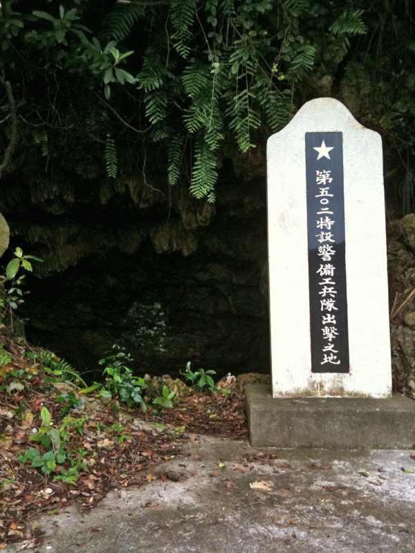
have cracked some of the code of that "502 Squadron Departure Site" mystery. Might
have cracked some of the code of that "502 Squadron Departure Site" mystery.While taking a bike ride last week I stumbled upon this cave and marker. It's about 50 meters give or take outside the side gate of our USMC range (gate closest to Wajee that's always locked). This monument and location is undocumented on the island tourist sites. My wife says that the marker says something like "502 started here". John. |
Click Here for a list of WW2 Fighter Groups
Click Here to go to the YellowAirplane Online Museum
|
|
|
|
|
|
|
|
|
|
|
|
